Google Maps Street View

Sharky

New Member
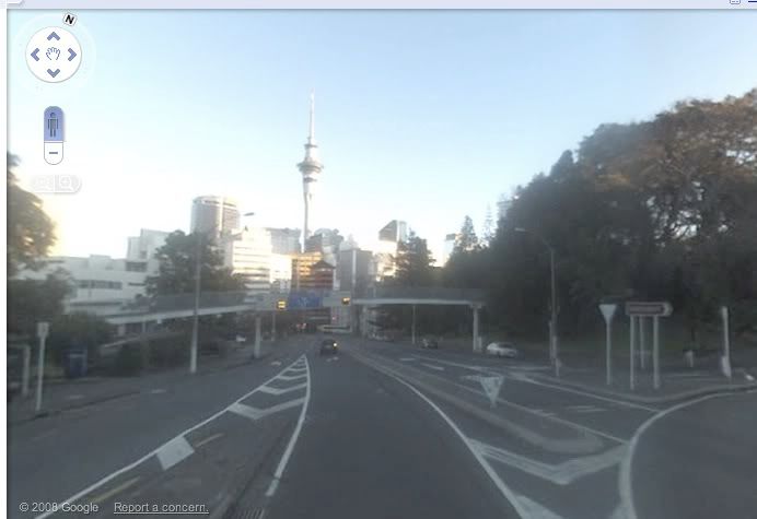
Washington County, FL finally made it onto Street View! They didn't go down many of the side roads, but they covered most of the highways and towns.

I'm really bored, so here's the fifty-cent tour of Vernon, the closest town to my place. :eyemouth:

The first one is downtown looking north, with City Hall on the left and the town square on the right.

The second one is City Hall (between the trees) with the church-run thrift shop on the left, and the grocery store (Dixie Dandy) on the right.

The next one is the town square, the white building on the left is the old fire station which now houses the town historical society, next to it is Dee's Restaurant, to the right of Dee's is the public library (the building with the red roof), and on the right is Mike's Tire Store.

The next one is looking south from the same spot. The big white building is Frank's Auto Parts, the small white building with the red roof in the distance on the same side of the road is KC's Pizza. The older building to the right of Frank's used to be the hardware store.
 

Sharky

New Member
More! The first one is our new volunteer fire department.

The second one is KC's Pizza (damn good pizza).

The next one is the Vernon Post Office (32462). Whee!

And last, but not least, is the bridge just north of the town square leading out of town. That's Holmes Creek, which borders the back of my property a couple miles upstream. If you go downstream by boat from here, you'll get to the Choctawhatchee River, which will take you to Choctawhatchee Bay, and across the bay is Destin and the Gulf of Mexico.

That pretty much covers Vernon. There ain't much else.

Post some landmarks from around your hometown! :cool:
 

Sharky

New Member
Thanks for the tour.

No street views in my area yet.

You're welcome. They'll eventually get to your area - apparently they have covered most of the large urban areas and are spreading out to the more rural locales. It was such a big deal when they posted our area it made the front page of yesterday's Panama City newspaper. :lloyd:
 

Inkara1

Well-Known Member
They covered this area a while ago. I actually saw a Google car going the other way once (a Chevy Cobalt with a 360-degree camera on a pole).

I need to get to bed now but at some point soon I'll post stuff. There's a lot of it.
 

Sharky

New Member
They covered this area a while ago. I actually saw a Google car going the other way once (a Chevy Cobalt with a 360-degree camera on a pole).

I need to get to bed now but at some point soon I'll post stuff. There's a lot of it.

Hey, cool! If you remember the location, look it up and see if you can see your car. That would be awesome.
 

chcr

Too cute for words
Cool!

Here's my driveway and the road to town. the driveway curves to the left and my house is hidden among the trees. The electric coop cut down the tree on the left last month. There's a stable on the right as you're facing the road to town.

Bucolicky, ain't it? :D

Edit: Note that they're widening the road to four lanes next year so the tree was going in any case.
 

MrBishop

Well-Known Member
They're still having trouble getting access to Canada...though Virtual City has no such problems :p
 

BeardofPants

New Member
Google maps street view is awesome. :D

Here's my neighbourhood:

The sky tower just down the road
sky_tower.jpg


The main street in Auckland
main_street.jpg


The ferry building downtown (I catch the ferry to work every day)
ferry_building.jpg


Entrance to my work (naval base)
devonport_base.jpg


And home
home1.jpg


home2.jpg
 

Inkara1

Well-Known Member
These are for Paso Robles, where I grew up...

1. Paso Robles High School. Class of 1999.

2. Here's the place I loved at from the end of March 2006 until April 2008, then moved because the landlord wans't paying the mortgage. That's my old Dodge Neon parked in front.

3. Downtown city park.

4. They rebuilt the old Acorn Building, which collapsed in the 2003 San Simeon Earthquake.
 

Inkara1

Well-Known Member
1. The Paso Robles library and city hall.

2. The backside of the library/city hall. In the 2003 earthquake, an old sulfur hot spring, which had been capped for decades, reopened. They had to dig a big hole to get to it and the fenced-in area is where it is. The smell of sulfur is common in Paso now.

3. The entrance to the Paso Robles Event Center, better known as the fairgrounds. The California Mid-State Fair is held here.

4. Where to go for quality dining in Paso.
 

Inkara1

Well-Known Member
Moving on to Atascadero, about 10 miles south...

1. Here's my office.

2. The old city administration building. It suffered a lot of damage in the 2003 earthquake and it's estimated to cost $25 million to fix. City Hall is now in the former bowling alley.

3. Atascadero Lake... in the background is the lake park, the Pavilion on the Lake and the Charles Paddock Zoo.

4. Where to go for quality dining in Atascadero. (That part of the main street in town is not on Google Street View. >.< )
 

Inkara1

Well-Known Member
Further south, Highway 101 climbs over the hills to descend into San Luis Obispo. Where it crosses is called the Cuesta Grade. Heading north, it's two or three miles of eight-percent grade. I've enclosed pictures of the top of the grade, the approximate midpoint and the bottom looking up.
 

Inkara1

Well-Known Member
More SLO...

1. Mission San Luis Obispo de Tolosa, which the town grew up around. Also in the shot is Mission Plaza.

2. McDonald's... I post this to point out that drive-thrus have been banned in SLO since 1982 and the city seems to be proud of this fact.

3. Here's where I was born... the former General Hospital building.

4. Whenever I quote the price at the "Chevron by my trailer" in the gas price thread, this is the one I'm quoting.
 

Sharky

New Member
2. The backside of the library/city hall. In the 2003 earthquake, an old sulfur hot spring, which had been capped for decades, reopened. They had to dig a big hole to get to it and the fenced-in area is where it is. The smell of sulfur is common in Paso now.
Are you serious? That is wild. Are they going to cap it or something? Time to call Bruce Willis.


4. Where to go for quality dining in Paso.
:beerbang:
 

Sharky

New Member
Cool!

Here's my driveway and the road to town. the driveway curves to the left and my house is hidden among the trees. The electric coop cut down the tree on the left last month. There's a stable on the right as you're facing the road to town.

Bucolicky, ain't it? :D

Edit: Note that they're widening the road to four lanes next year so the tree was going in any case.

LOL - that's pretty much what it looks like 1 mile outside of Vernon. Miles and miles of farms, planted pines and woods. And they are starting work on four-laning through Vernon. All the buildings on the west side of the road are being torn down. City hall and the thrift shop are already gone, KC's, Franks, the Dixie Dandy and the GoCo (gas station) have closed and will be torn down soon. :(
 
Top